Displaying 26 - 30 of 103
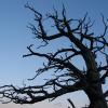
Whitebark pine (Pinus albicaulis) is a critical forest species of Northern Rocky Mountain upper subalpine ecosystems, yet little is known about the physiological response of whitebark pine to disturbance (e.g., fire, bark beetles, and pathogens)…
Landscape-scale maps of vegetation structure and fuels can support management decisions but are lacking for most landscapes. Researchers used remotely sensed data (LiDAR, aerial imagery) and a vegetation map coupled with field data to map canopy and…
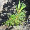
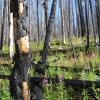
Presented by Camille Stevens-Rumann and hosted by the Northern Rockies Fire Science Network and the Association for Fire Ecology, this webinar covered a recent review published in the Journal of Fire Ecology on tree regeneration following wildfire…
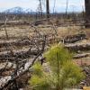
The NRFSN partnered with Sustainable Northwest and the Northwest Fire Science Consortium to share information about a JFSP funded research project that evaluates the "work of wildfires" on the landscape and helps identify post-fire management needs…
The Northern Rockies Fire Science Network partnered with the Montana Department of Natural Resources and Conservation’s (DNRC) Forestry Division to share information about the development of a statewide wildfire risk assessment. The risk assessment…